
The Old Oak neighbourhood area lies in East Acton, in the London Borough of Ealing. The original application for designation dates from 2017 and was for a large 280 hectare area for which the Old Oak and Park Royal Development Corporation (OPDC) and LB Hammersmith and Fulham were the relevant local planning authorities.
Both these planning authorities ‘refused’ this application. LBHF instead designated a neighbourhood area at the Old Oak Estate with a tightly drawn boundary which gave limited scope for any neighbourhood plan. This designation remains in place, as one of London’s ‘orphan’ neighbourhood areas for which no neighbourhood forum has been established.
The OPDC chose to designate a 22 hectare area in East Acton, arguing that this location included most of the existing residential settelements within the eastern half of the OPDC boundary.
The details of the the orginal application from what was then an ‘interim’ Old Oak Neighbourhood Forum remain available on the OPDC website.
The Old Oak neighbourhood boundary was varied slightly by a OPDC decision in 2021. This decision was in reponse to an application from the Forum to extend the boundary to include the land owned by the Department of Transport at Channel Gate and Atlas Road. These sites are currently in use by HS2 as construction compounds. OPDC ‘refused’ this application in 2021.
The 2021 designated area is shown below:
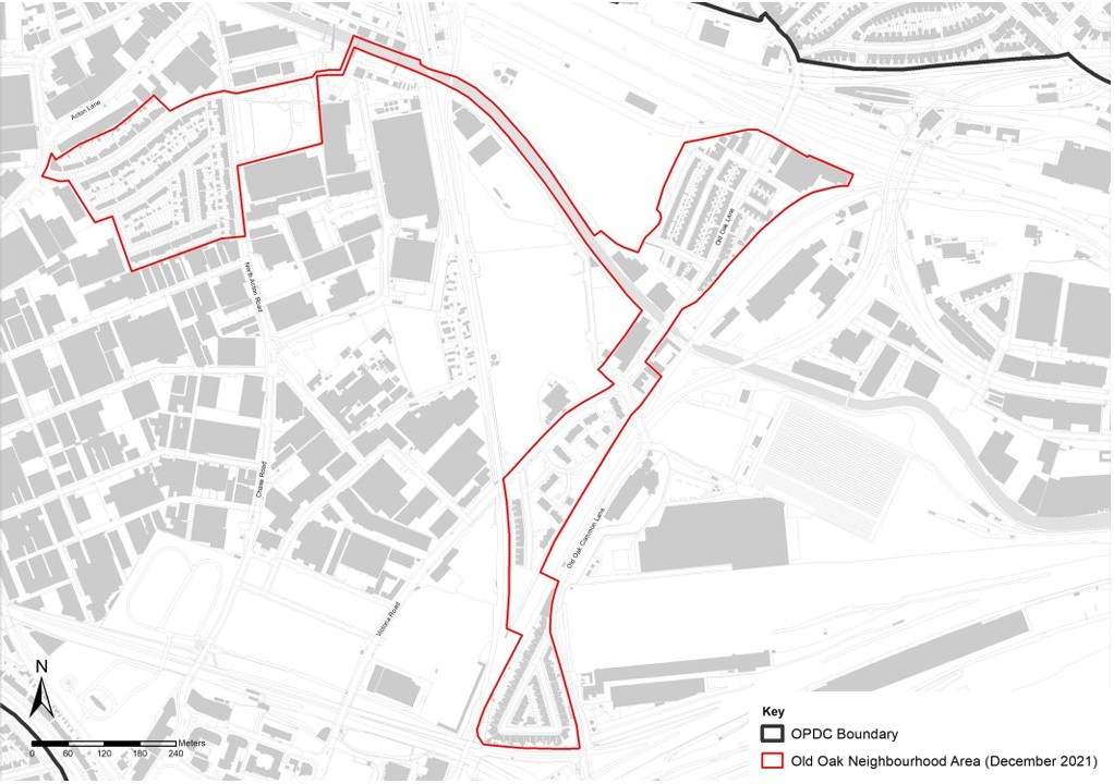
This part of East Acton includes the following residential areas, from north to south:
The Wesley Estate – an area of 1930s houses built originally as company housing by stationery manufacturer Harold Wesley and subsequently sold to private owners. There are 230 houses, isolated by industrial premises in Park Royal and North Acton Road, in Harold Road, Newark Crescent and Wesley Avenue. Represented by the Wesley Estate Residents Association.
The ‘Railway Cottages’ also known as the Island Triangle or TITRA area These are several streets built as 220 railway cottages in Victorian times and designated as a Conservation Area in 1982. Bordered by Willesden Junction station and the West Coast mainline (WCML) to the north, the Willesden Euroterminal to the west, Powerday to the east and Atlas Road to the south. Represented by TITRA (The Island Triangle Residents Association).

Midland Terrace and Shaftesbury Gardens – Midlands Terrace consists of 35 Edwardian terraced houses, some converted into flats and others remaining as family homes. Shaftesbury Gardens is a relative recent (1990s) development of 170 flats (housing association and owner occupied) with communal outdoor space.
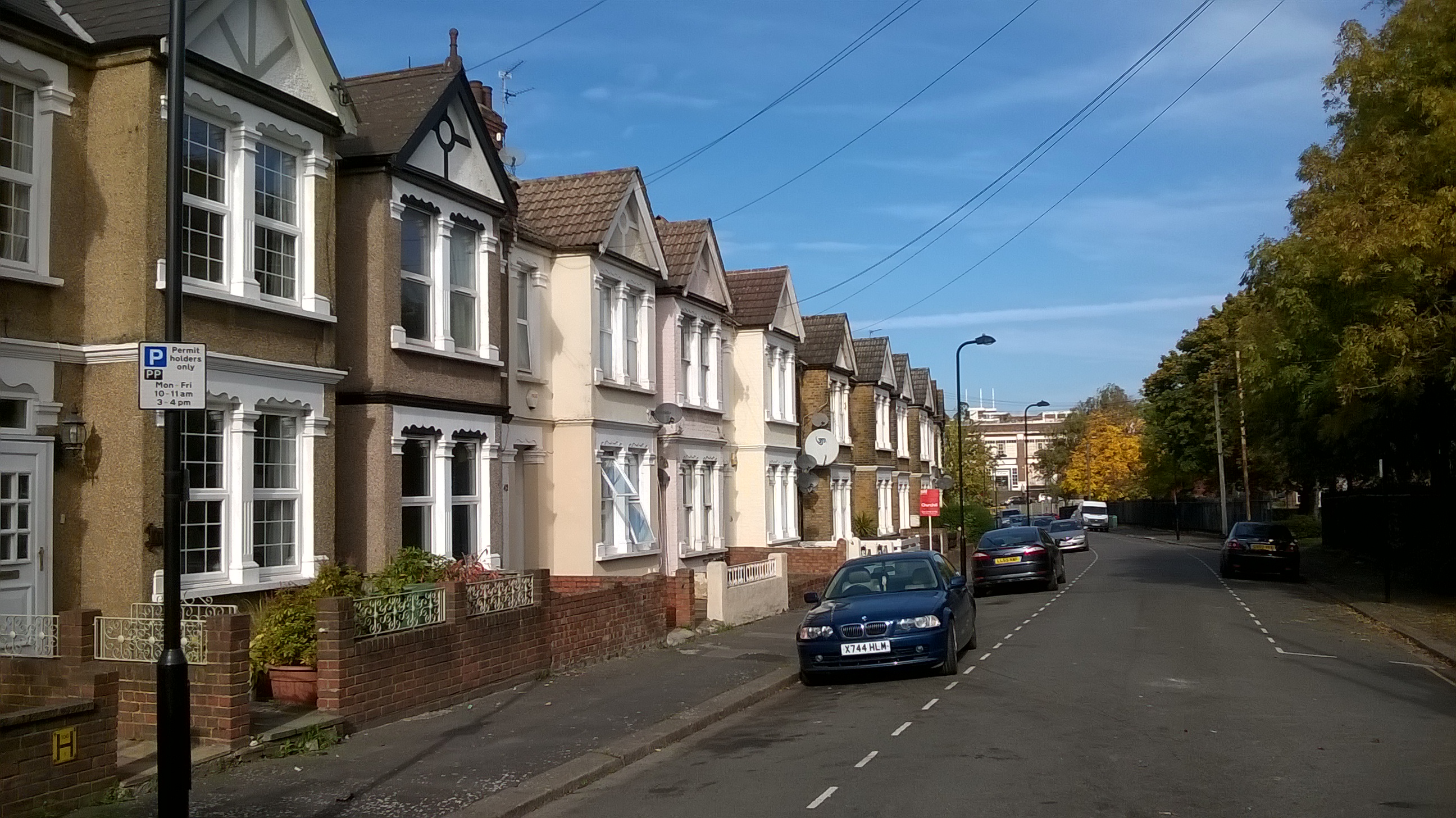
Wells House Road – a small enclave of 120 Edwardian semi-detached houses, very close to the proposed location of the main HS2 station at Old Oak Common. The potential impact of HS2 plans are enormous, for the long-term and during a decade of construction (including the proposed future closure of Old Oak Common Lane in order to lower the roadway beneath bridges). Represented by Wells House Road Residents Association.
OPDC’s 2019 shift to the Western Lands
When OPDC defined the the original neighbourhood boundary back in 2017, it was focusing its attention on early development at ‘Old Oak North’. This ‘Place’ included Scrubs Lane and the 45 acres of land for which Cargiant Ltd and London & Regional Properties has worked up detailed proposals for 6,000 new homes and a ‘major town centre’. This location was expected to host a new Overground station on the West London Line (now the Mildmay Line).
Although at an advanced stage, these proposals were dropped by in 2018 by Cargiant as the landowner. In September 2019 the Planning Inspector examining the OPDC’s Draft Local Plan concluded that OPDC’s proposals for Old Oak North were unviable. OPDC subsequently announced a ‘new focus’ on the area west of the OOC station site, which the Development Corporation badged as ‘the western lands’.
OPDC has since prepared an 2024 Old Oak West Supplementary Planning Document, a Regeneration Strategy and a 2025 Masterplan Framework for this part of East Acton. It is by accident rather than design that the Old Oak neighbourhood area lies at the centre of what OPDC now refers to as its ‘project area’.
OPDC has purchased or acquired control of a series of land holdings in this project area, borrowing over £300m from Greater London Land and Property in the process. A Compulsory Purchase Order covering the whole project area remains subject to future decision by the Secretary of State, with a planning inquiry expected in autumn 2026.
It is against this background that the Old Oak Neighbourhood Forum decided to resume work on preparing a Draft Neighbourhood Plan. Details of this are elsewhere on this website.